


Voting District 1475296000002, St. Clair County, Michigan
About
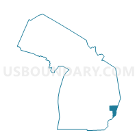
Outline

Summary
| Unique Area Identifier | 599434 |
| Name | Voting District 1475296000002 |
| County | St. Clair County |
| State | Michigan |
| Area (square miles) | 0.52 |
| Land Area (square miles) | 0.49 |
| Water Area (square miles) | 0.03 |
| % of Land Area | 94.35 |
| % of Water Area | 5.65 |
| Latitude of the Internal Point | 42.89906670 |
| Longtitude of the Internal Point | -82.76810980 |
Maps


Graphs
Select a template below for downloading or customizing gragh for Voting District 1475296000002, St. Clair County, Michigan


Neighbors
Neighoring Voting District (by Name) Neighboring Voting District on the Map
- Voting District 0995296000001, Macomb County, MI
- Voting District 1476862000001, St. Clair County, MI
- Voting District 099684000002, Macomb County, MI
Top 10 Neighboring County Subdivision (by Population) Neighboring County Subdivision on the Map
- Richmond township, Macomb County, MI (3,665)
- Riley township, St. Clair County, MI (3,353)
- Memphis city, Macomb County, MI (823)
- Memphis city, St. Clair County, MI (360)